Editorial catalogue with km from Entrago
What to see on the Bear Trail
Bear enclosure, gorges, tunnels, viewpoints and picnic areas: the 12 must-sees with exact km from Entrago and a link to the full sheet where relevant.
See the 12 points01
Category 01 · 04
Nature and wildlife
Bear enclosure, viewpoints and landscape
3 points in this category
- 01
Fernanchín bear enclosure (Paca and Molina)
Km 19Santo Adriano
The tourist heart of the trail. A 40,000 m² semi-wild facility where Paca and Tola lived and where Molina, rescued in 2013, now lives. There is a trail-side viewpoint with free open access. Dogs and pets are not allowed inside the site.
Full sheet - 02
Proaza natural viewpoint
Km 14Proaza
A wider stretch of the trail just before entering Proaza village, with an open view over the river Trubia and the ridge along the trail. Perfect for a short sandwich stop. The natural break most cyclists take.
- 03
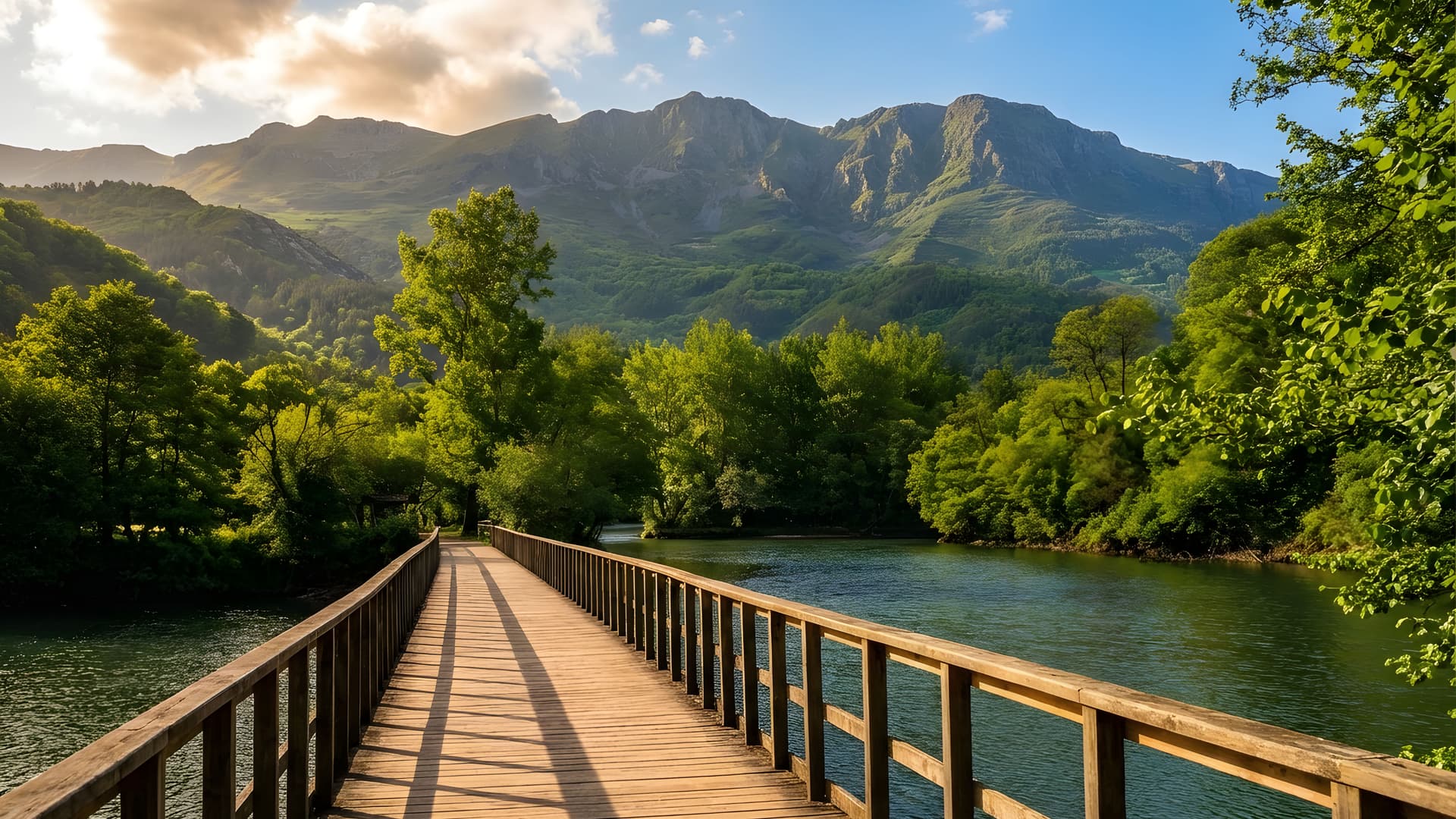
The Aramo crags
Km 15visible from Proaza and Santo Adriano
Not a point you visit, but a permanent backdrop. From several stretches of the main trunk you can see the silhouette of the Aramo massif on the horizon, with peaks above 1,700 m. In spring and autumn, with lingering snow on top and green below, it is the most repeated postcard of the trail.
02
Category 02 · 04
Mining-railway engineering
Gorges, tunnels and bridges
4 points in this category
- 04
Peñas Juntas gorge
Km 12Proaza
Narrow canyon carved by the river Trubia, with nearly vertical limestone walls and several short tunnels in a row. The railway line clings to the rock face. One of the most photographed points on the trail.
Full sheet - 05
Valdecerezales gorge
Km 15Proaza / Santo Adriano
Longer and more dramatic than Peñas Juntas. Vertical walls on both sides, the river squeezed below and the railway route hanging on the wall. The most spectacular industrial landscape on the greenway.
Full sheet - 06
The long railway tunnels
Km 13several
Of the more than 30 tunnels on the route, around 6-8 are longer than 150 m. The most remarkable ones are concentrated on the middle section. All have photovoltaic lighting. The interior curvature is the original mining-railway one.
Full sheet - 07
The iron bridges over the Trubia
Km 16several
Several original mining-railway bridges cross the Trubia river and its tributaries. Some are in dressed stone, others in steel truss. The industrial profiles contrast with the riverside forest — another very popular photo spot.
03
Category 03 · 04
Picnic areas and stops
Where to eat, rest or pull over
3 points in this category
- 08
Buyera picnic area
Km 18Proaza
End point of the most popular tourist route. Picnic area with tables, drinking fountain, parking, a seasonal bar and direct access to the river. This is where the Teverga branch ends and the main trunk begins. If you have come by bike with transfer, this is where you call us.
- 09
Proaza village centre
Km 14Proaza
Just 200 m off the route. An obligatory lunch stop: bars with terraces, Asturian restaurants, a pleasant square. After the bear enclosure, it is the longest natural break point.
- 10
Tuñón picnic area
Km 22Santo Adriano
Start of the main trunk from the north. Car park, tables, drinking fountain and access to the pre-Romanesque church. If you ride the full route downhill (Entrago → Tuñón), this is the end point.
04
Category 04 · 04
Heritage and culture
Pre-Romanesque church and prehistory museum
2 points in this category
- 11
Santo Adriano de Tuñón church
Km 19Santo Adriano
Asturian pre-Romanesque church consecrated in 891 under the reign of Alfonso III. It keeps its original Mozarabic wall paintings. Classified Bien de Interés Cultural. 300 m detour from the trail; visit in 15-20 minutes.
- 12
Teverga Prehistory Park
Km 2Teverga
Museum opened in 2007 with a replica cave that reproduces rock paintings from Altamira, Tito Bustillo, Niaux and Chauvet. Ideal as a complementary family visit, especially with children aged 6-12. Paid entry.
How to plan the visit
3 plans depending on the time you have
The trail works from 3 spare hours up to a full weekend. These are the three formats our customers go for most.
- 01
Half a day
3-4 hShort route Proaza → Tuñón (6 km) on foot or by bike.
Covers: Bear enclosure · Valdecerezales gorge (partly) · several long tunnels · Tuñón church.
Perfect for families with small children or a first visit on a tight schedule.
- 02
A full day
6-7 hEntrago → Buyera by bike (18 km downhill) + return transfer to Entrago.
Covers: Both gorges · all long tunnels · bear enclosure (stop) · Buyera · Proaza centre for lunch.
The most popular plan and the one we recommend to anyone coming for a single day.
- 03
Two days · weekend
weekendDay 1: full route Entrago → Tuñón (22 km). Day 2: Parque de la Prehistoria + Tuñón church + short Quirós branch.
Covers: All 12 points + museum + stay in Proaza or Teverga.
For a couple or family who want to make the most of the visit. Accommodation in Proaza or Teverga.
The most comfortable way
12 points in 2-3 hours
on wheels
Most people ride it with a return transfer included. Booking is free, no advance payment, no card. Cancel for free up to 24 h before.
Where it starts Gorges Tunnels Paca, Tola and Molina Downloadable map
- 01
You cover more in less time
All 12 points in 2-3 downhill hours with photo stops.
- 02
No uphill pedalling
Return transfer from Buyera included. We do the climb, you do the descent.
- 03
Easy for everyone
Compacted surface at 1.5 % gradient. Anyone rides it with no training.