Skip to content
The Bear Trail (Senda del Oso), greenway in central Asturias

Greenway · Asturias · since 1995

The Bear Trail complete guide to the most visited greenway in Asturias

36 km greenway built on the old 19th-century mining railway. It crosses the councils of Teverga, Proaza, Santo Adriano and Quirós. This is the guide written by those of us who have been riding it for more than 20 years.

Want to ride it by bike?

See our rental
36 km Y-shaped greenway
+30 Tunnels
1.5% Average gradient
Easy Difficulty
What the Bear Trail is

What is it?

A greenway on a 19th-century mining railway

The Bear Trail (Senda del Oso) is one of the most visited cycling routes in Asturias. Here are the key facts that make it unique.

Greenway · 36 km

From mining railway to greenway

36 km Y-shape
+30 Tunnels
1995 Greenway

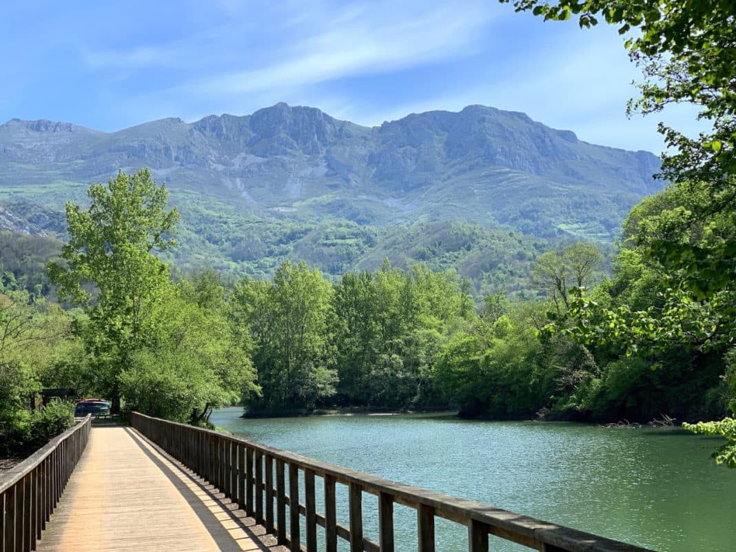
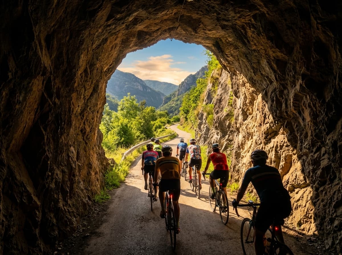
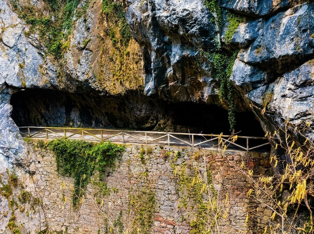
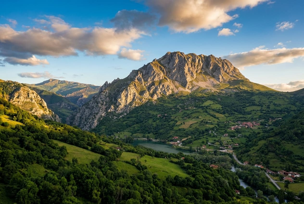
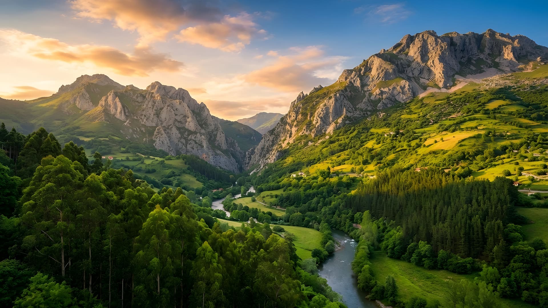
The Bear Trail is a greenway built on the route of the old mining railway that, for nearly a century (late 19th century to 1963), carried coal from the Teverga and Quirós valleys down to the steel works in Trubia.

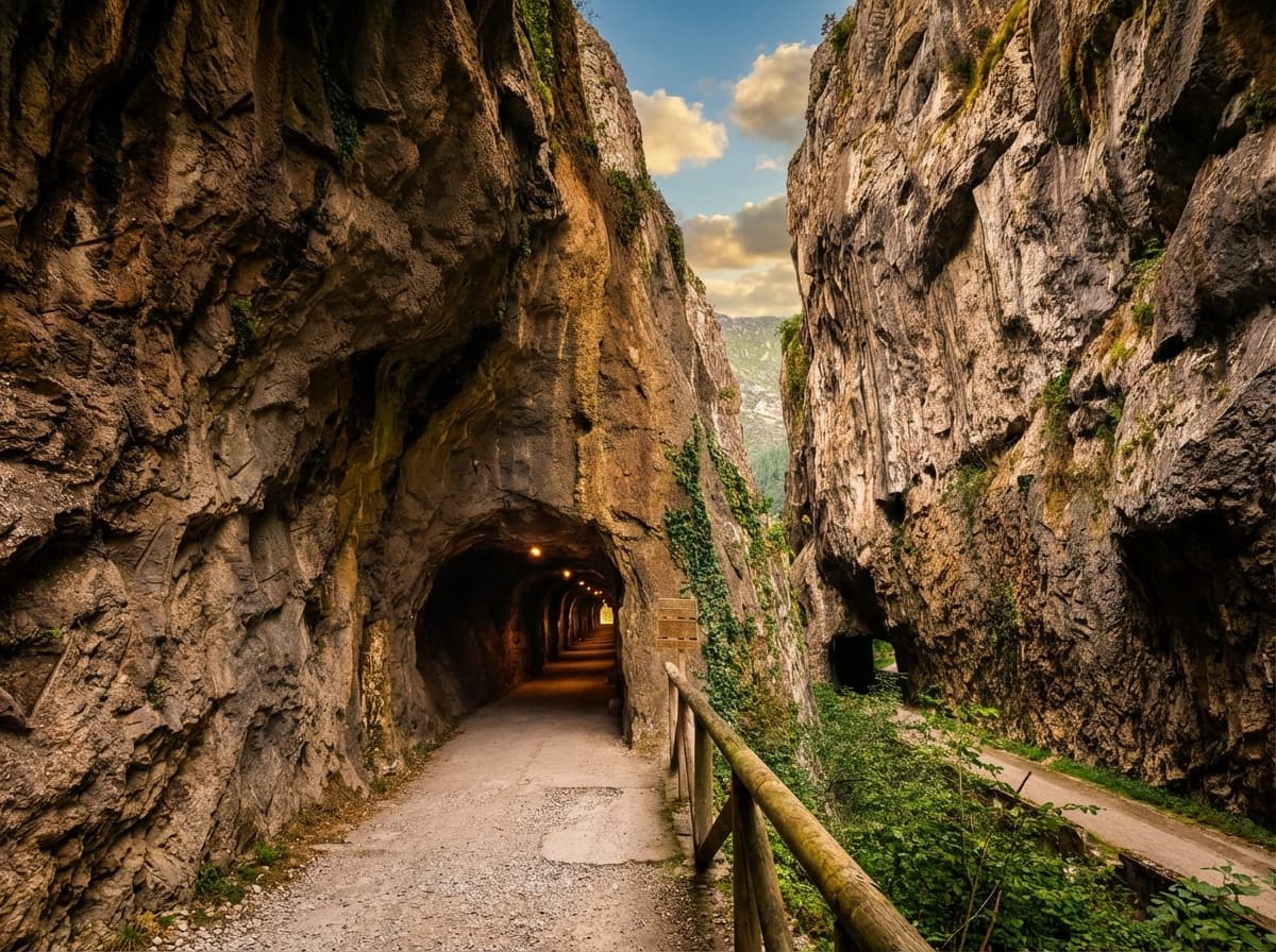
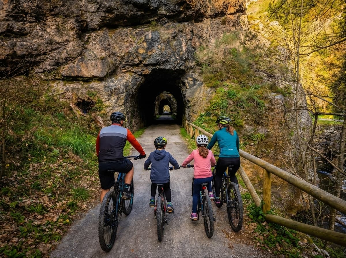
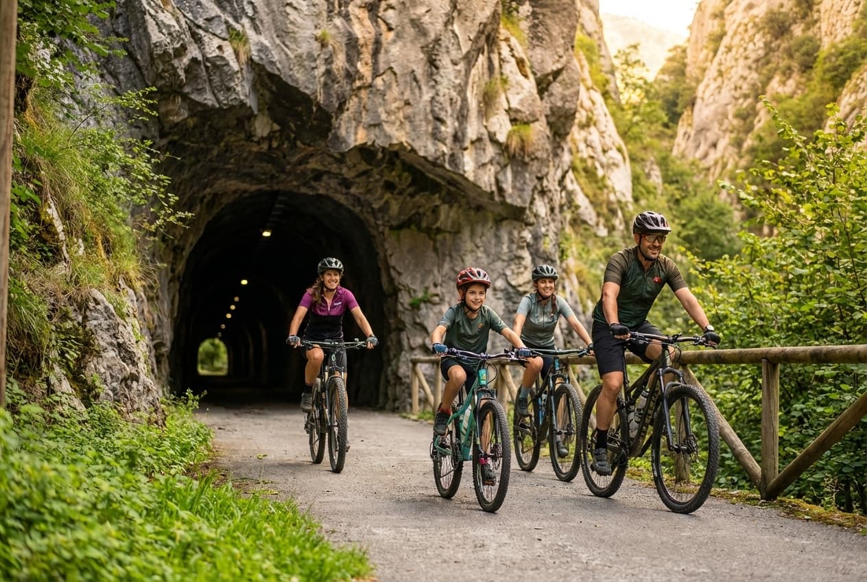
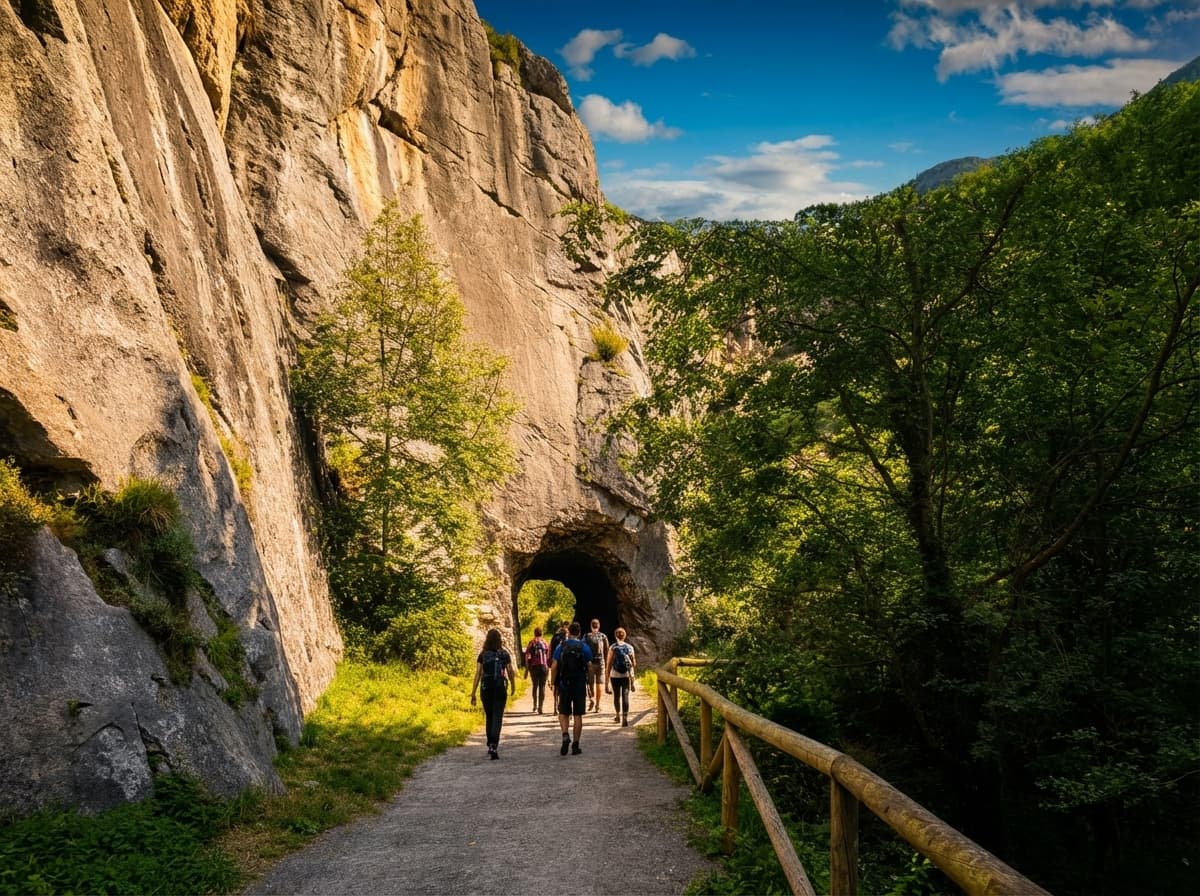
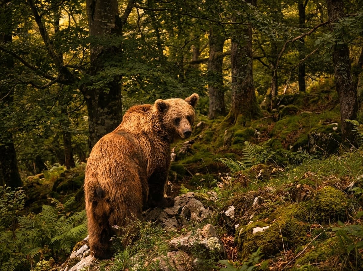
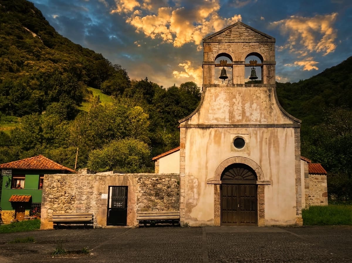
After the mines closed, the tracks were abandoned until in 1995 the Principality of Asturias turned them into a Greenway, as part of the national network coordinated by the Spanish Railway Foundation. It crosses four councils (Teverga, Proaza, Santo Adriano and Quirós), passes through more than 30 rock-cut tunnels, several limestone gorges and Atlantic riverside woodland, and ends at the bear enclosure run by the Asturian Bear Foundation, now home to Molina.

Its Y-shape makes it unique in Spain: a main trunk leaves Tuñón, climbs to Caranga and there splits towards the Teverga valley (Entrago) and the Quirós valley (Santa Marina).

  • Built on the old mining railway
  • Crosses 4 Asturian councils
  • Y-shape: trunk + 2 branches
  • 1.5% gradient · almost flat
See the trail map
The Bear Trail greenway crossing the Asturian valleys
Greenway19th-century railwayAsturias

Before you go

What you need to know before going

Routes are presented starting from Entrago downhill — the way most people ride it.

Ask us

Technical profile

1.5 %

Average gradient

Practically flat · −200 m downhill

  • Total descent −200 m
  • Difficulty Easy
  • Surface Compacted gravel
  • Lit tunnels +30
  • Best season All year
FamilyGreenway

Duration

2-3 h

By bike at an easy pace

With stops and lunch it fills the whole day

  • Walking full section 5-6 h
  • Kid-friendly Yes, from babies
  • Dog-friendly Yes
  • Wheelchair accessible Yes (in sections)
KidsDogWheelchair

The 3 sections

A Y-shaped trail

The Bear Trail is Y-shaped. Starting from Entrago downhill, the first section is the Teverga branch, then the main trunk towards Tuñón, and from Caranga a third branch heads to Santa Marina (Quirós valley). Each section has its own character.

Teverga branch downhill from Entrago, Valdecerezales gorge 01

Teverga branch · downhill

Entrago → Caranga

11 km downhill · vertical landscape

  • Valdecerezales gorge
  • Vertical limestone walls
  • Short tunnels

The branch that plunges into the Valdecerezales gorge, with hundred-metre limestone walls framing the path. A bold piece of mining engineering, where the trail runs almost suspended over the river Teverga.

The first section if you start from Entrago. The most dramatic.

Main trunk Caranga-Tuñón with Molina enclosure and tunnels 02

Main trunk · downhill

Caranga → Tuñón

The star section · 11 km downhill

  • Molina enclosure
  • Peñas Juntas gorge
  • Longest tunnels

Crosses the river Trubia over the La Esgarrada bridge and runs through riverside woods of alders, poplars and ash trees. Passes the Molina enclosure half-way (a must stop), the Peñas Juntas gorge and several lit tunnels.

Natural continuation of the Teverga branch. Concentrates the most popular landmarks.

See the Molina enclosure in detail
Quirós branch downhill with Valdemurio reservoir and rural landscape 03

Quirós branch · downhill

Caranga → Santa Marina

The quietest · 14 km downhill

  • Valdemurio reservoir
  • Villages with hórreos
  • Less crowded

The Quirós branch is the quietest. It passes the Valdemurio reservoir — crystal-clear water with activities such as kayaking — and carries on to Santa Marina, through farming landscapes and villages with hórreos (traditional granaries).

A quiet alternative. A detour into the Quirós valley and its rural scenery.

Want to compare all three sections in detail? See the full comparison

How to do it

By bike or on foot

Both options are valid and the trail is designed for both. Each has its audience — and you can combine them (bus there + walk back, for example).

Family riding the Bear Trail by bike

By bike

The most popular way

The tourist route is Entrago → Buyera: 18 km downhill that take 2-3 hours at an easy pace, stopping to eat, to see the Molina enclosure and to photograph the tunnels. To make it longer, add the detour to the Valdemurio reservoir (Entrago → Valdemurio → Buyera).

Everyone rents in Entrago and returns by transfer from Buyera — that is what makes it comfortable by bike without having to pedal back uphill. You never have to ride all the way to Tuñón.

See how our rental works
Walking the Bear Trail

On foot

By sections, at your own pace

The best approach is to pick a section to match your fitness (from 2 km to the full Y). The Buyera → Proaza → Tuñón section (6-7 km) is the top family-friendly pick — it concentrates the main landmarks and takes about 2.5 hours with kids.

To walk the full trail, allow 5-6 hours at a strolling pace. The return can be combined with the bus (ALSA line from Oviedo).

Bear Trail on foot

What to see

The 6 must-see landmarks

What makes the Bear Trail unique are its six must-stop landmarks. Swipe through the cards to see each one in detail.

Molina enclosure on the Bear Trail

01 · The most visited

Molina enclosure

Asturian Bear Foundation

Half-way along the trail, in the council of Proaza, is the bear enclosure run by the Asturian Bear Foundation — a large reserve home to Molina, a Cantabrian brown bear rescued in 2013.

For years the enclosure was home to Paca and Tola, two orphan bears that arrived in 1989 and became a symbol of brown bear conservation in Asturias. Tola died in 2018 and Paca on 10 April 2025. Today Molina remains, living semi-wild and visible from a free lookout right next to the trail.

Full story of Paca, Tola and Molina
Peñas Juntas gorge, limestone walls nearly touching

02 · Spectacular geology

Peñas Juntas gorge

Karst canyon of limestone walls

One of the most spectacular geological formations in Asturias. The limestone walls almost touch, creating a karst canyon with a unique atmosphere.

The trail crosses its base, exactly where the river Trubia has carved its way through over thousands of years. One of the most photographed spots on the route.

Tunnels of the old mining railway on the Bear Trail

03 · The unique feature

The Tunnels

+30 tunnels carved into the rock

Along the route you pass through more than 30 tunnels carved into the rock during the 19th century for the mining railway. Some over a hundred metres long, all now fitted with solar-powered lighting.

The most photographed are the Buyera tunnels and those on the Tuñón-Caranga stretch. The longest measures 300 m on the Teverga branch, with side openings overlooking the river.

Tunnels in detail
Valdemurio reservoir in the Quirós valley

04 · To extend the day

Valdemurio reservoir

Lake in the Quirós valley

A crystal-clear sheet of water reflecting the peaks of Quirós. It sits on the Santa Marina branch and offers outdoor activities (kayaking, paddle-boarding in summer).

A perfect stop if you want to extend the day or combine the bike with a swim in the middle of Asturian farming country.

Valdecerezales gorge with vertical limestone walls

05 · The most dramatic

Valdecerezales gorge

Teverga branch · vertical walls

Hundreds-of-metres-high limestone walls, path suspended over the river Teverga. The most dramatic section of the trail, with several short tunnels and dizzying views.

Traditionally less busy than Peñas Juntas — perfect if you want quiet and spectacular scenery.

Pre-Romanesque church of Santo Adriano de Tuñón

06 · Pre-Romanesque gem

Church of Santo Adriano

Tuñón · Historic-Artistic Monument

At the northern start of the trail, the Church of Santo Adriano de Tuñón is a 10th-century pre-Romanesque gem listed as a Historic-Artistic Monument.

A must-see before or after the trail — it stands 200 metres from the Tuñón car park. It preserves original mural paintings from the Asturian period.

How to get there

40 minutes from Oviedo by car

The main access is Entrago (Teverga). Free car parks at Entrago (60 spaces), Tuñón (40) and Proaza (20). In high season arrive before 10:00. There is also a regular bus from Oviedo Bus Station.

Oviedo Cathedral, starting point for the Bear Trail Car
Oviedo 40 km · 45 min
See route
  • Distance40 km
  • Duration45 min
  • RouteA-63 + AS-228

From the capital via the A-63, exit 9 to Trubia and AS-228 to Entrago.

Gijón, starting point for the Bear Trail Car
Gijón 70 km · 1 h
See route
  • Distance70 km
  • Duration1 h
  • RouteA-8 + A-66 + A-63

From the coast, A-8 to Oviedo then A-63. About an hour, mostly motorway.

León Cathedral, starting point for the Bear Trail Car
León 85 km · 1 h 15
See route
  • Distance85 km
  • Duration1 h 15
  • RouteAP-66 + P. Ventana

AP-66 Huerna, exit Villablino / Caldas de Luna towards Puerto Ventana.

Somiedo to Bear Trail route Car
Somiedo 45 km · 50 min
See route
  • Distance45 km
  • Duration50 min
  • RouteAS-265 + P. San Lorenzo

From the Natural Park via AS-265 through the San Lorenzo pass.

Free car parks

In high season arrive before 10:00

  • 60 Entrago spaces · main access
  • 40 Tuñón spaces · start of the trunk
  • 20 Proaza spaces · near the enclosure
Bus from Oviedo to the Bear Trail Bus
Pullmans Llaneza 55 min · from Oviedo
Timetable

Also by bus

Autos Bimenes regular line

The company Autos Bimenes (Pullmans Llaneza) runs a regular line from Oviedo Bus Station to the different points of the trail with stops at Tuñón (start of the trunk), Proaza (near the enclosure), Caranga and Entrago (start of the Teverga branch). Useful for combining bus out with walking or cycling back.

  • Origin Oviedo Station
  • Stops 4
  • Duration ~55 min

Want the full details (exact routes, timetables, coordinates)? How to get there — full guide

With the family

One of the most comfortable family routes in Asturias

Flat, shaded, with bears half-way and tunnels that delight little ones. The ideal family section is Entrago → Buyera: 18 km downhill by bike, very easy, with all the highlights along the way — the Molina enclosure, the tunnels and the gorges.

By bike at an easy pace it takes 2-3 hours with stops. We pick you up in Buyera with the transfer and bring you back to Entrago, so you never have to pedal uphill. For babies and toddlers, child seats and bike trailers work perfectly.

  • Tunnels lit by solar power
  • Rest areas with picnic tables
  • Drinking fountains in Entrago, Proaza and Buyera
  • Bars and restaurants at every stop
Bear Trail with kids — full guide
Family with kids riding the Bear Trail
FlatShadedWith bearsTunnels

When to go?

Spring and autumn are the best seasons

The trail can be ridden all year, but not every season is equal. Quick guide by season so you can plan when to fit your visit.

Full calendar

Summer

Jul–Aug

Very busy

Rideable but crowded. Arrive before 10:00. Shade along much of the route.

Top

Autumn

Sept–Oct

Second best

Ochre colours, no crowds, seasonal food.

Winter

Nov–Mar

Still rideable

Surface can be slippery. Lit tunnels. Shorter daylight.

Before you come

Practical tips from people who know it

A short list of things we always mention when someone asks about the trail. It all fits in a small backpack — no technical gear needed.

  • Lighting

    Tunnels have solar-powered lights, but always carry a headtorch or your own front and rear bike lights. Daylight doesn't always reach inside.

  • Footwear

    Closed trainers work perfectly. No flip-flops — the surface is compacted gravel with loose stones.

  • Gear

    Light rain jacket even in summer (this is Asturias). Sun cream and a cap between June and August.

  • With dogs

    Always keep the dog on a lead. Don't approach the livestock guardian dogs (mastines) in the villages.

    Dog-friendly guide
  • Parking

    In high season arrive before 10:00 — car parks fill up quickly.

  • Respect

    Don't leave any waste, not even organic. The trail is a wildlife area.

  • Overnight

    There are camper-van areas in Tuñón, Proaza, Entrago and Teverga.

FAQ

Frequently asked questions about the Bear Trail

Quick answers to what first-time visitors ask: kilometres, sections, access points and the Molina enclosure.

View of the Bear Trail by bike

Need help?

+34 644 199 430
1.

How many kilometres does the Bear Trail have?

The Bear Trail totals 36 km in a Y shape. The main trunk (Tuñón–Caranga) is 11 km. From Caranga it splits to the Teverga valley (11 km to Entrago) and the Quirós valley (14 km to Santa Marina). The most popular tourist route is the 22 downhill km (Entrago → Tuñón), which takes 2-3 hours by bike.

2.

Which is the prettiest section of the Bear Trail?

The most popular and landmark-packed section runs from Proaza to Tuñón via Buyera. It concentrates the Peñas Juntas gorge, the Molina enclosure and several tunnels of the old railway. It is also the top pick on foot with children. For a more dramatic, quieter section, try the Caranga-Entrago branch (Valdecerezales).

3.

Can you walk the Bear Trail?

Yes, perfectly. The compacted gravel surface is very comfortable to walk on. The best approach is to pick a section for your fitness: the 6-7 km Buyera-Proaza-Tuñón is the family pick. For the full route on foot, allow 5-6 hours at a strolling pace. The return can be combined with the ALSA bus from Oviedo.

4.

Where are Paca, Tola and Molina?

Paca and Tola were the two Cantabrian brown bears that lived in the enclosure run by the Asturian Bear Foundation from 1989. Tola died in 2018 and Paca on 10 April 2025. Today Molina remains, a bear rescued in 2013 that lives semi-wild in the same enclosure. You can see her from a lookout right on the trail in the council of Proaza.

5.

When is the best time to visit the Bear Trail?

The best seasons are spring (May-June) and autumn (September-October): lush landscape and fewer visitors. In summer the route is very busy, arrive before 10:00. In winter it remains rideable but the surface can be slippery and daylight is shorter.

6.

Is it accessible for people with reduced mobility?

Yes over much of the route. The compacted gravel surface and 1.5% gradient allow electric wheelchairs or handbikes on the flat sections. The Entrago, Tuñón and Proaza car parks have reserved spaces and access ramps onto the trail.

7.

Is there free parking?

Yes. Free car parks at the main points: Entrago (60 spaces), Tuñón (40 spaces) and Proaza (20 spaces). In high season (July-August, long weekends, Easter) they fill up before 10:00.

8.

Is there a bus to the Bear Trail?

Yes. Autos Bimenes (Pullmans Llaneza) runs regular lines from Oviedo Bus Station to the various points of the trail. Especially useful for walking the trail by combining an outbound bus with a walk back.

When you are ready

If you want to ride it, we can help

For over 20 years we have been renting bikes for the Bear Trail (Senda del Oso) from our shop in Entrago, right at the start of the route. More than 200 bikes checked every day, helmet and insurance included, return transfer from Buyera. Book without paying in advance.