Teverga branch
Entrago → Caranga
11 km
- Elevation
- −170 m
- Difficulty
- Easy
- Valdecerezales
- Short tunnels
Best for Cyclists · dramatic landscape
3 sections, one Y-shaped route
The Bear Trail (Senda del Oso) is Y-shaped: Tuñón–Caranga trunk plus two branches towards Teverga and Quirós. Here is every section in detail — kilometres, elevation, landmarks and which to pick depending on who you come with.
Start by seeing the YThe Y shape
The Bear Trail is not a linear route. On the map it draws a Y: a common trunk that starts in Tuñón, climbs to the Caranga junction and there branches into two different valleys (Teverga and Quirós).
This structure is a direct consequence of the original rail layout — the mining train collected coal from both valleys and brought it together at Caranga on its way to Trubia.
Today you can ride just one section, two sections combined or the full Y (36 km), but the most common choice is Entrago → Buyera (18 km downhill) with return transfer.
Bear Trail
Asturias · 36 km in Y
Comparison
Kilometres, elevation, difficulty and main landmarks. The trunk is the most booked by groups and families.
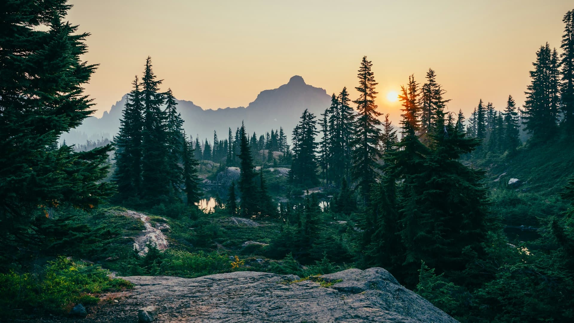
See detailTeverga branch
Best for Cyclists · dramatic landscape
Main trunk
Best for Families · photography
Quirós branch
Best for Quiet · fewer people
Most popular tourist route: Entrago → Tuñón · 22 km downhill combining Teverga + trunk. 2-3 h by bike.
Each section
Section 1 · main trunk
11km
Distance
−30m
Descent
Veryeasy
Difficulty
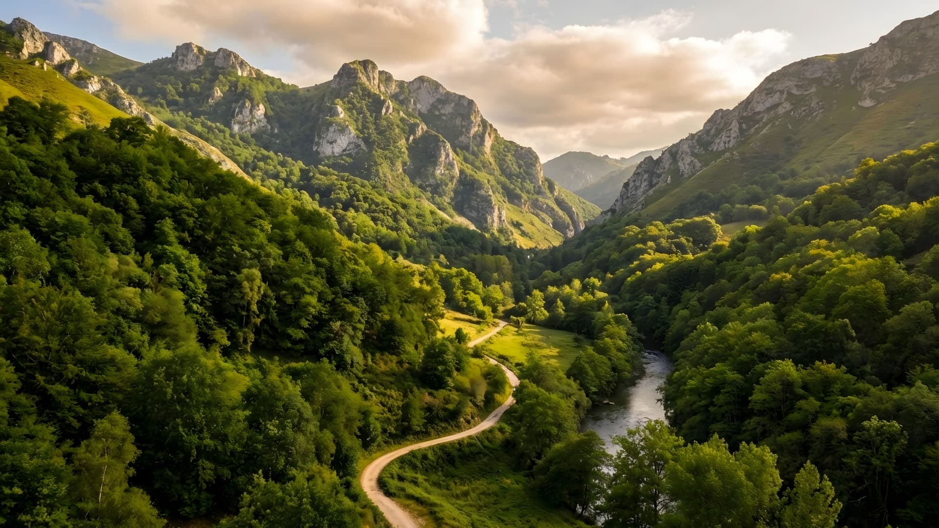
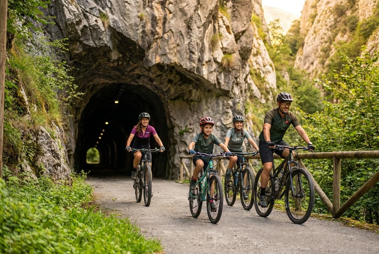
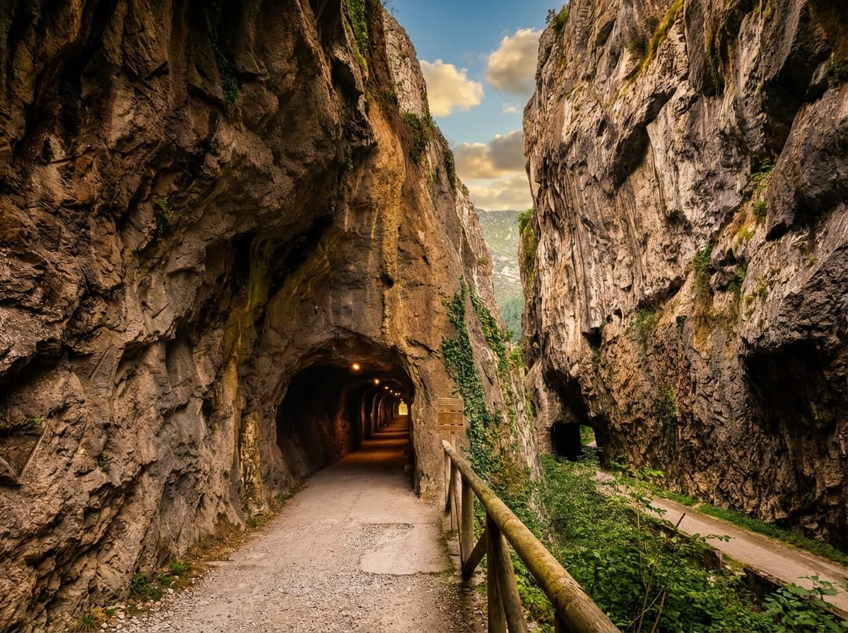
This is the star section. It concentrates the three most photographed landmarks of the whole trail: the Molina enclosure (around the middle), the Peñas Juntas gorge (limestone walls almost touching) and the long tunnels of the old railway — including the longest on the trail (300 m).
Maximum density of highlights per kilometre. If you only do one section, choose this one.
The busiest. In July-August and Easter there are groups every few minutes.
How to do it
Which to pick?
Four quick profiles to pick a section without overthinking.
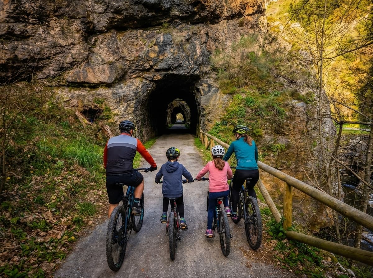
With family
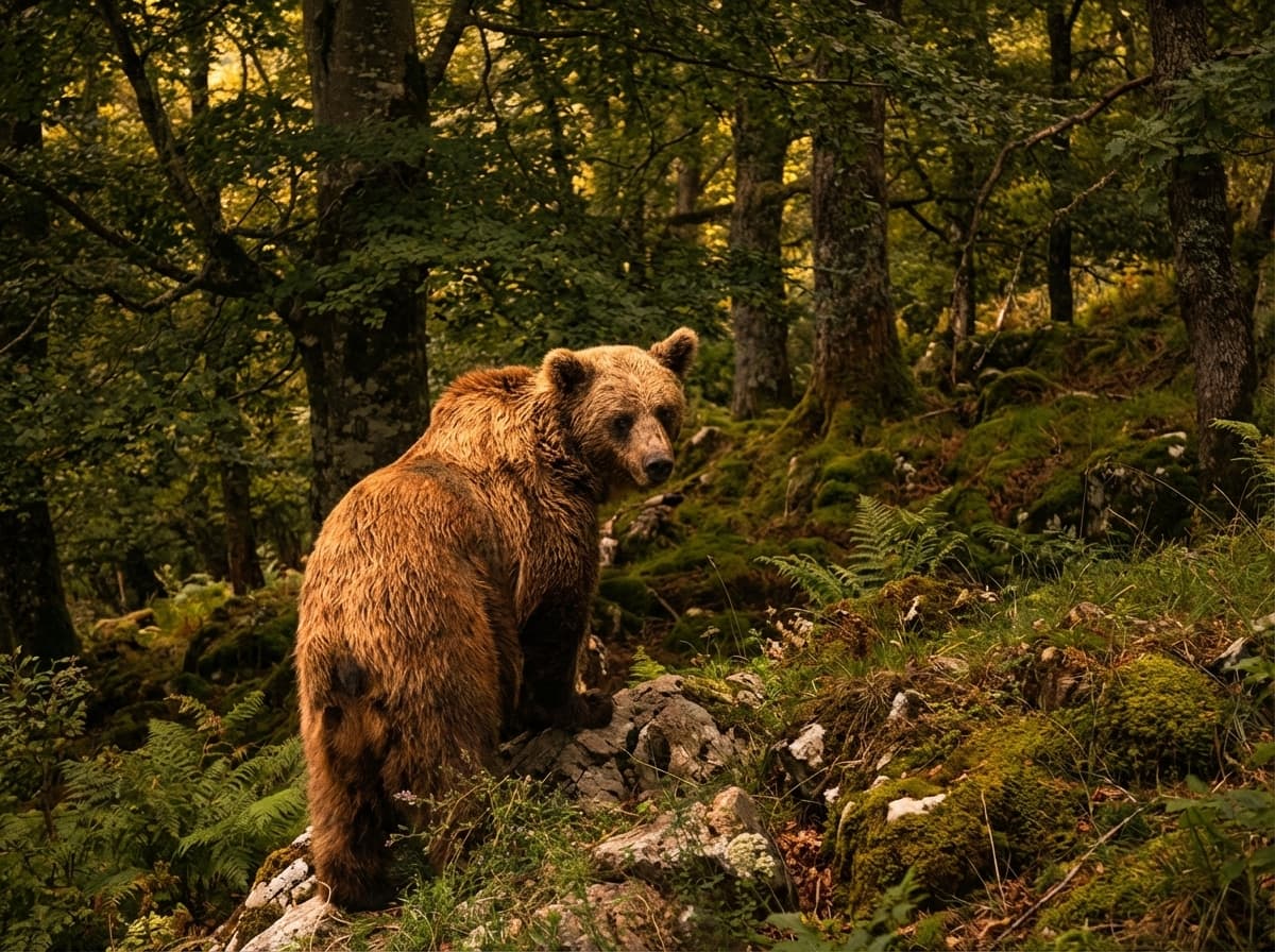
Section 1 (Tuñón → Caranga) or just Buyera → Proaza → Tuñón (6 km). Contains the bears, the lit tunnels, fountains, rest areas and is practically flat. By bike with kids it takes about 1.5 h.
18 km short route
The well-known "short route" runs Entrago → Buyera (18 km): it combines the Teverga branch downhill plus part of the trunk up to the Molina enclosure. It takes 2 h by bike at an easy pace and is the most booked option among tourist groups.
Photography · dramatic landscape
Section 2 (Caranga → Entrago) downhill. The Valdecerezales gorge is the most photogenic location on the whole trail. Pair it with a detour to the Valdemurio reservoir for variety.
Quiet · fewer people
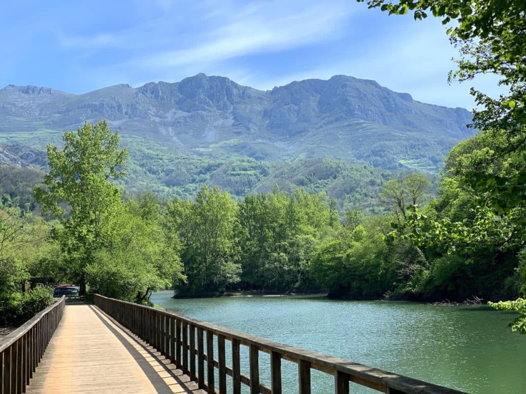
Section 3 (Caranga → Santa Marina). Quiet, authentic farming landscape, Valdemurio reservoir as an optional stop.
Can they be combined?
The full Y in one day, the 18 km short route, or something in between with a detour to the reservoir. All with return transfer so you don't have to pedal back uphill.
Ask for a routeShort route
Teverga branch downhill + part of the trunk up to the Molina enclosure. The most booked by groups. Return transfer included.
Full route
Like the short one but with a detour to the Valdemurio reservoir. Adds the stop by the water and the Quirós peaks.
Full Y
All 3 sections in one day (5-6 h with stops). Return combined car/bus. Only for those who want to do the entire Y.
FAQ
Quick answers to what people ask before choosing a section.
Need help?
+34 644 199 430The Tuñón → Caranga section (main trunk) is the most popular and landmark-packed: Molina enclosure, Peñas Juntas and the longest tunnels. For a more dramatic landscape, the Valdecerezales gorge (Teverga branch) is the most photographically spectacular. There is no objective "prettiest section" — each has its own appeal.
The standard short route is Entrago → Buyera: 18 downhill km that combine the Teverga branch + part of the trunk up to the Molina enclosure. It takes 2 h by bike. It's the most booked route among tourist groups.
36 km. The Tuñón-Caranga trunk is 11 km, the Teverga branch (Caranga-Entrago) is 11 km and the Quirós branch (Caranga-Santa Marina) is 14 km. The most popular tourist route is the 22 downhill km of Entrago → Tuñón, combining 2 sections.
The Teverga branch (Caranga → Entrago) uphill has +170 m cumulative, the most demanding. Downhill it's the most enjoyable. The other two sections are practically flat.
The main trunk (Tuñón → Caranga) is the best: compacted gravel surface, 1.5% gradient, with adapted car parks in Tuñón and Proaza. The branches are rideable but with more uneven parts.
Yes. Autos Bimenes (Pullmans Llaneza) run lines from Oviedo to various points on the trail. Useful if you do a single section and want to combine bike out + bus back. If you rent with us, the return transfer from Buyera is included.
When you are ready
For over 20 years we've been renting bikes for the Bear Trail. Rental in Entrago, return transfer from Buyera included, helmet and map. Choose the section that fits you best and we handle the rest.
Preferencias de cookies